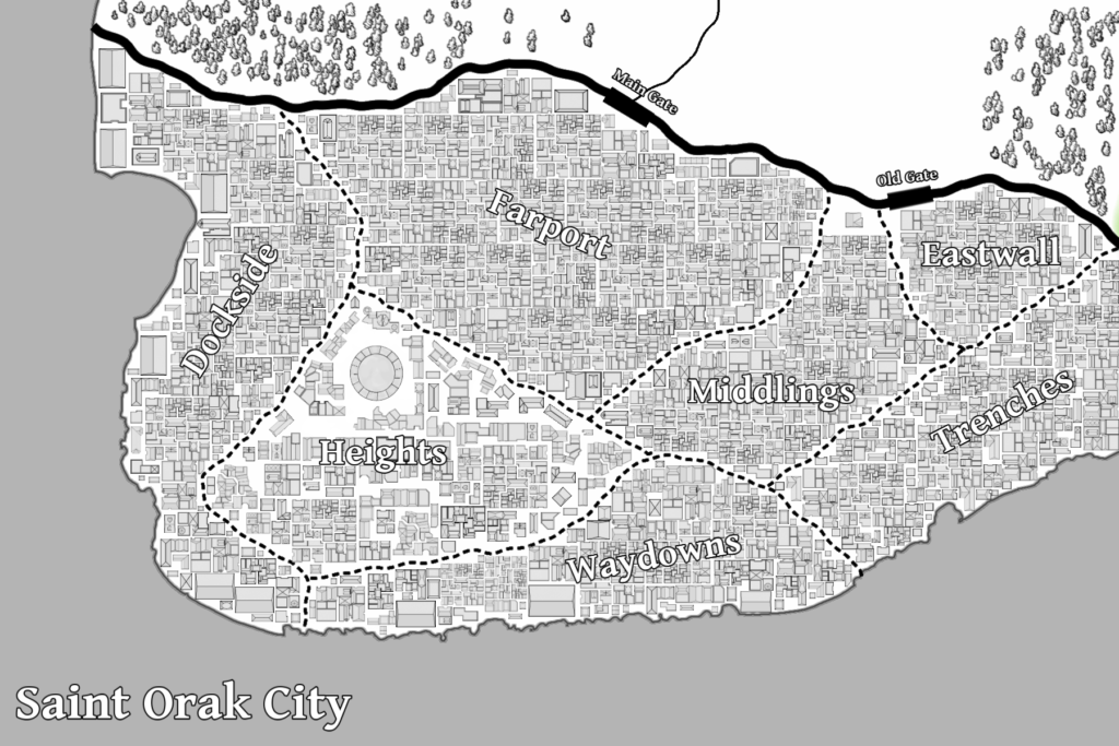
Thought I’d share a preview of one of the maps from Fatedancer today. Most of the story takes place in or around the city of Saint Orak, which is one of the most populated locations on the planet (Equivalent to NYC).
The map itself was quite an undertaking, and took close to seven hours to complete, since most of those building had to be placed in one at a time. Still, I think it was quite worth it—the whole thing really has a real-city feel to it, which hopefully transfers to the book as well.
As you can see in the image below, the city is quite dense right up to the walls, after which there is little in the way of civilization shown. While there are towns and other settlements that lie outside the walls, due to the constantly respawning monsters that are common both inside and outside the walls, most of humanity tends to favor defensiveness in their building choices. Thus, even farms out in the wilderness will usually have fences and armed patrols around their perimeters.
Inside Saint Orak itself, a plethora of guilds work collaboratively (sometimes) to keep the resident monster populations in check. This means that most citizens can live their lives in relative safety, but rarely venture outside the walls. When travel is required, going by sea is typically the preferred method, since monster incursions are usually far less frequent.
The city is divided into seven districts, although their borders and names tend to fluctuate over time. Trenches and Waydowns remain the poorest districts in the city, while Heights exists almost as a city-within-a-city, allowing the wealthier citizens to stay as near to the city’s best protections against monster attacks as possible.